http://ccusc.maps.arcgis.com/apps/webappviewer/index.html?id=0278e06efd4d4207857b6c355a06d8be h
Attached above in a link to an interactive web map that shows the general locations of the artifacts featured in the exhibit before they were in the Horry County Museum.
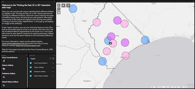
The link will lead to a page that looks like the image above. Initially all layers are checked, showing all artifacts in the exhibit. The viewer can then click through the different layers to look at prehistoric, historic, and natural history artifacts by groups.
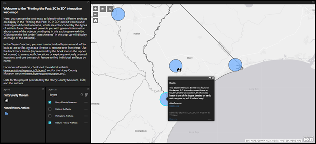
When an artifact is clicked on, a pop-up will appear that gives information about the artifact and how it relates to Horry County. It also includes images of the artifact under the attachments section. More information is available for each individual artifact on the digital exhibit page of the website.